Uploading a CSV
Pick a CSV on the New Data Layer page. A latitude / longitude pair is mapped directly. An address column is mapped through the local geocoder.
basic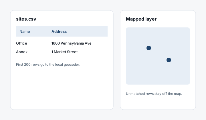
If your spreadsheet has latitude and longitude columns, you can turn it into a mapped data layer without renaming anything first. On the New Data Layer page choose Import, pick the file, and the ingest service works out which columns are the coordinates and which are the attributes.
A file with no coordinates can still land on the map when it has an address column, or a street column plus a city. The server sends the first 200 rows to the Nominatim instance configured for this portal and stores a point for each match. Rows that do not match are left out. The public Nominatim service is not used for this, because a spreadsheet is a bulk lookup and the addresses stay on the host. If that local geocoder is not running, the file imports as a table, the same as before.
If your data is in Excel, save it as CSV first: File → Save As → CSV. The portal reads .csv, .tsv and .txt, but not .xlsx directly.
How the detection works
When you upload a .csv, .tsv, or .txt file, the server scans the column headers and the first few rows looking for a latitude / longitude pair. It matches against a vocabulary of common names:
- Latitude side:
lat,latitude,latitude_decimal,lat_dd,y,y_coord,northing,point_y. - Longitude side:
lng,lon,long,longitude,longitude_decimal,lon_dd,x,x_coord,easting,point_x.
Capitalization doesn't matter. Underscores, dots, and spaces in column names are ignored for matching ("Lat (decimal)" matches "lat").
After identifying a candidate pair, the server validates that the column values actually look like coordinates:
- Latitudes between -90 and 90.
- Longitudes between -180 and 180.
- A majority of the sampled rows have valid numeric values in both columns.
If the candidate pair fails the value check, it's discarded and the next candidate is tried. If no pair survives, an address column is tried next, as described below.
Files we already handle
- Comma-delimited (
,) — the standard CSV. - Tab-delimited (
\t) — common from spreadsheet "Save as TSV" or pasted from a wiki table. - Semicolon-delimited (
;) — common in European Excel exports. - UTF-8 BOM at the start of the file is tolerated.
- European decimal commas like
40,7are recognized when the file uses semicolons as delimiters (so the comma in the value isn't confused with the field separator).
When the file has addresses
If no coordinate pair is found, the server looks for one column named address (also full address, site address, mailing address, or property address), or for street plus city, with optional state and zip. A majority of the sampled rows have to look like addresses, not bare numbers.
Only the first 200 data rows are geocoded. The lookup runs against the portal's Nominatim (NOMINATIM_URL, or the local default). A public Nominatim URL is refused for this path.
When it falls back
The upload proceeds as an attribute-only or geometry-from-WKT layer when:
- No coordinate pair and no address columns were found.
- An address column was found, but the local geocoder is not running.
- Values that looked like coordinates were actually UTM eastings / northings (out of the WGS84 lat/lng range).
- The file had no parseable data rows.
If the local geocoder is running and matches none of the rows, the import stops and says so, instead of creating an empty map.
In those cases the existing geospatial driver kicks in. If your file has a geometry column with WKT or a .shp / .gpkg / .kml / etc. sibling, that path will pick the geometry up.
Tips for a smooth upload
- Use simple column names when you control the source file.
latandlngalways work and read clearly in the attribute table later. For addresses,addressorstreetpluscityis enough. - Numeric coordinates should be decimal degrees, not degrees-minutes-seconds.
- If your spreadsheet exports with quoted fields, that's fine — the parser handles
"40.7","Site name with, comma".
What happens next
Once the layer ingests, it appears as a new data layer item you own. Drop it onto any map to render it as a point layer with all the other columns available as attributes.